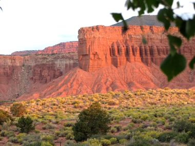
2007-09-14: Campsite View
We once again have a beautiful view of the red rock cliffs out our front window. Their color was further enhanced as the sun set.
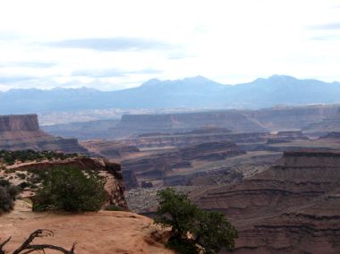
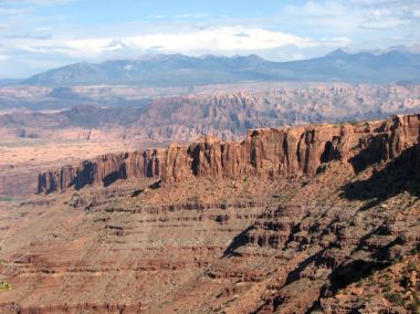
2007-09-15: Canyonlands National Park
Canyonlands is 527 square miles and is divided into three distinct regions by the Colorado and Green Rivers. Island in the Sky to the north is the only part of the park with a paved scenic drive. The views from the cliffs above the valley floor were incredible.
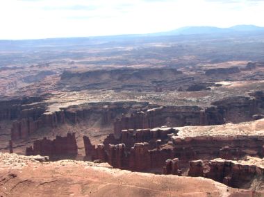
2007-09-15: Monument Basin
Monument Basin looks out toward the Colorado River. The sign said that from here we can see some 100 miles away.
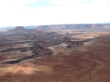
2007-09-15: Green River Overlook
Looking out to the east we see the erosion caused by the Green River.
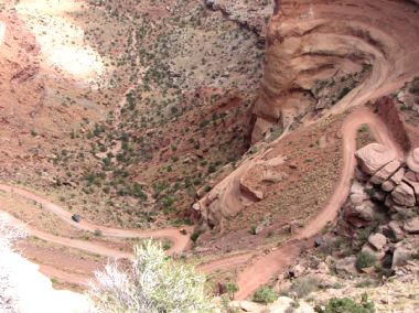
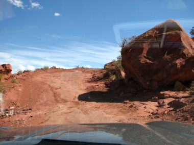
2007-09-15: Shafer Trail
Years ago this switchback was developed by a cattleman named Shafer so that he could bring his herd to high ground in the summer and low in the winter. Today it is a jeep road. When we saw this at around 2:00 in the afternoon we knew we wanted to try it. The ranger said the run would take about 2-1/2 hours so off we went!
2007-09-15: Switchbacks
This is how the road looked from inside the jeep as we made our way down!
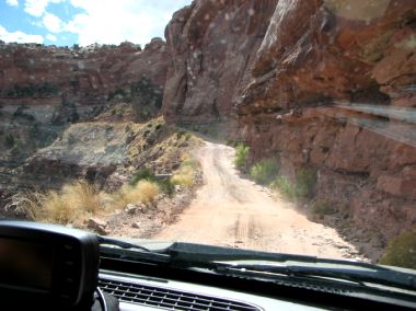
2007-09-15: Along the Trail
Continuing down the road widened and the drop-off disappeared...
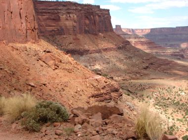
2007-09-15: Rock Formations
...but the scenery and rock formations were incredible.
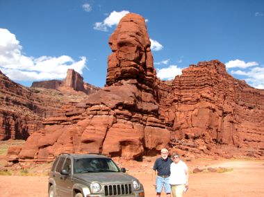
2007-09-15: Gooseneck
As we continued along the trail we came to a point where the Colorado goosenecked. As we stood up on the cliff, a sightseeing jetboat came downriver. As we waved, they blew their horns. We were amazed they could see us as we were high above the river on the red rock cliffs.
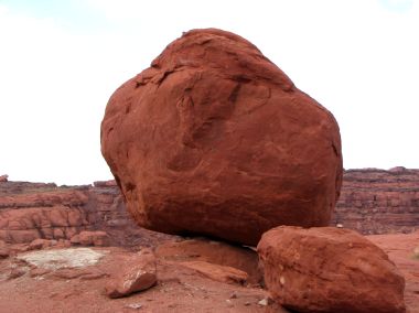
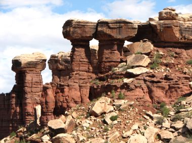
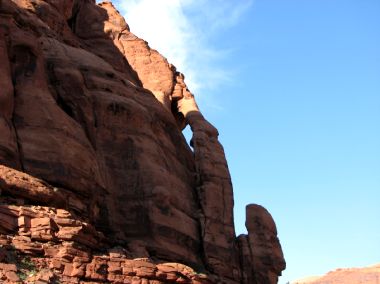
2007-09-15: Balancing Rock
It always amazes me that these huge boulders can balance atop another rock.
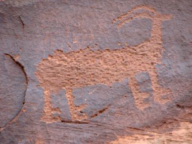
2007-09-15: Petroglyphs
There are many places in the Moab area to find great petroglyphs. We saw these on our way back into town on the Potash Road. We also saw some dinosaur tracks there too.

2007-09-16: Arches National Park
Water and ice, extreme temperatures and underground salt movement are responsible for the sculptured rock scenery in Arches. We've been here before but had never hiked out here to Double Arch before.
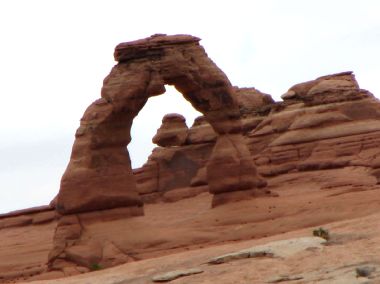
2007-09-16: Delicate Arch
A trip to this National Park just isn't complete unless you've taken the time to visit Delicate Arch, an isolated remnant of a bygone fin.
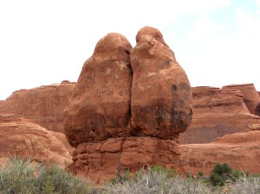
2007-09-16: Full Moon
We call this formation full moon or butt rock!
2007-09-17: Gemini Bridge
We had met a couple from Georgia in Torrey and bumped into them again here. They had never gone jeeping so we took them on an adventure. The trail to Gemini Bridges begins by switchbacking up the cliff to the top. What an introduction for Ginny and Ron!
2007-09-17: Long Canyon
Once we finished that run, we decided to try the Long Canyon Trail. We enjoyed this run far better than the one to Gemini Bridge. We saw majestic vistas...
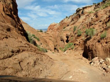
2007-09-17: The Canyon
...a narrow canyon with the road switchbacking down...
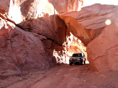
2007-09-17: Rock Bridge
...a rock bridge to go through...
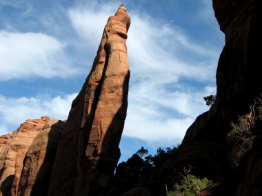
2007-09-17: Spire
...incredible spires...
2007-09-17: Jug Handle Arch
...and Jug Handle Arch!