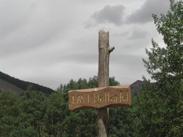
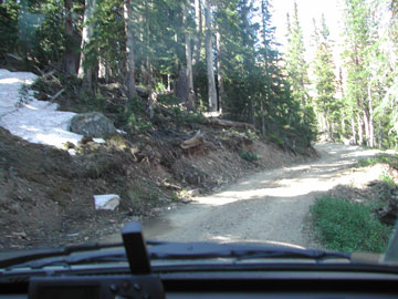
2004-06-21: Last Dollar Road
Our first backcountry run with our new Jeep was on Last Dollar Road, which is rated class 1 or easy. What an incredible journey this was for us!
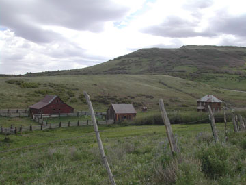
2004-06-21: Deserted Farm
Driving along we came upon this wonderful old deserted farm. Most of the buildings were still standing creating a picturesque scene for us to enjoy. It is still early in the season here so the jeep runs are relatively quiet.

2004-06-21: Aspen Forest
We came upon this aspen forest and just stopped and admired it with open mouths. It's difficult to find words to describe the beauty of this kind of forest.
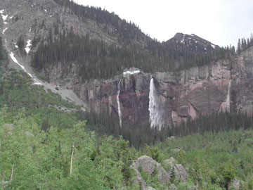
2004-06-21: Bridal Veil Falls
Ouray is home to several beautiful waterfalls one of which is directly across from our campsite. Bridal Veil Falls, at the other end of town, falls hundreds of feet fanning out its water as it comes down.
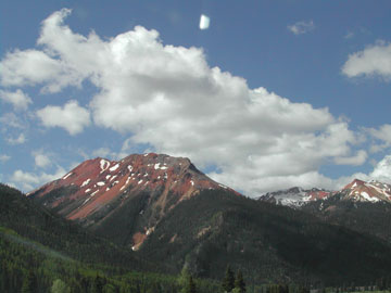
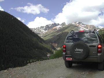
2004-06-22: Red Mountain
We drove part of the Million Dollar Highway today. This 6-mile section of highway is ranked one of the nation's most spectacular car routes. It features chasms so deep that neither cliff tops nor canyon bottoms are visible on either side. It's a white-knuckle kind of road! This is a view of the Red Mountains, which tower over the highway.
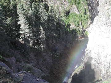
2004-06-22: Bear Creek Falls
Bear Creek Falls cascade under the highway into the canyon below. We were treated not only to a view of the falls but a rainbow as well.
2004-06-22: Ophir Pass
This trail was originally a wagon road between the mines in Ophir, Telluride and Silverton. We are being a little more adventurous with this as it is rated Class 2 that is a little more difficult. The ascent was gradual to the top, winding through aspen forests and past beautiful mountain wildflowers.
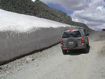
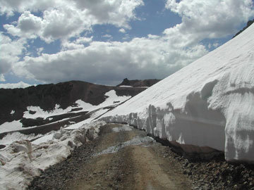
2004-06-22: The Summit
Imagine our surprise when we rounded a switchback and found this bank of snow! Ophir Pass is at an elevation of 11,800 feet. The views here were spectacular. We descended the trail via a narrow, shelf-like road. What great fun this is!

2004-06-22: Alta Mountain
We needed a bit more jeeping today so we decided to take the trail to Alta Lake. Everywhere we look there is yet another beautiful, high mountain.
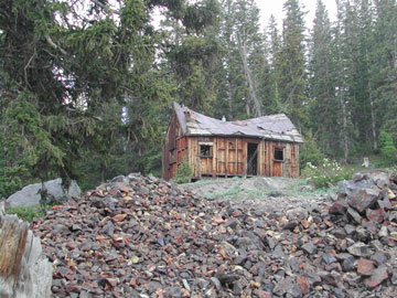
2004-06-22: Alta Mine
We came upon the old Alta mine that is nothing more than a ghost town today. What fun it was to see the buildings the old miners lived in. Al totally enjoyed seeing all the equipment laying around.
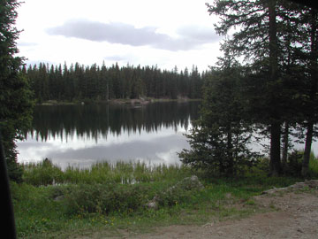
2004-06-22: Alta Lake
When we reached Alta Lake, our GPS said we were at 11,000 feet. Here we saw fly fishermen, horseback riders and some kids playing in the snow. I don't know how they do it - I'm having trouble breathing at this altitude.
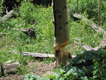
2004-06-22: Beaver at Work
We ate our picnic lunch above a large beaver dam. Can you believe that these little animals have got this huge aspen ready to fall? I never realized that these little critters would tackle a tree so huge.

2004-06-23: Our Waterfall
Our campground is located right on the Uncompahgre River. Just across the highway not only do these beautiful mountains rise above us but we have our own beautiful waterfall.
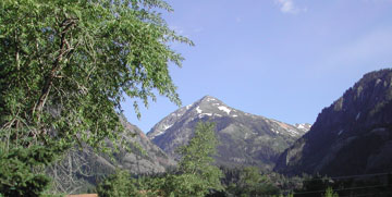
2004-06-23: Our Mountains
This is the glorious view we see out our motorhome window.
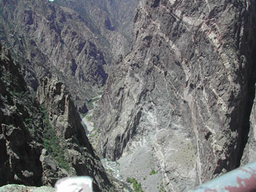
2004-06-23: Black Canyon of the Gunnison
We decided to take a break from jeeping and visit Black Canyon, the newest National Park in the US. It is an extremely deep gorge that is so sheer and narrow that very little sunlight can penetrate it. At one point, the gorge is 2,772 feet deep!

2004-06-23: Colorado Rockies
I just can't resist taking photos of the majestic mountains in this area. Enjoy them with us.
2004-06-24: Corkscrew Gulch
Today we graduated to a Class 3 run - Corkscrew Gulch. It climbs to a summit of 12,930 feet via switchbacks that are steep and narrow. What a rush!
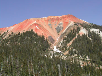
2004-06-24: Red Mountains
There are three famous Red Mountains (1, 2, and 3). From looking at this photo of Red Mountain 2 you can see where they get their name. As we climbed, the air got thinner and breathing more difficult. Needless to say, we didn't do any hiking here!

2004-06-24: Lake Como
Imagine our surprise when we reached Hurricane Pass (12,407) and found Lake Como frozen over. It was about 55 today when we were there. We have seen some gorgeous wildflowers up here - we may be forced to buy a wildflower book for the area so we can identify them.
2004-06-24: California Pass
It's amazing to think that we're driving above the tree line but we are! This stretch of "road" led us to California Pass, which has an elevation of 12,930 feet. It's really difficult to describe the beauty we've seen up here - hopefully these photos will give you a glimpse.
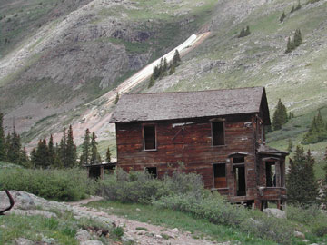
2004-06-24: Animas Forks Ghost Town
It was thrilling to see such a well-preserved 1870's mining town. The community boasted having a hotel, general store, saloon, post office and 30 cabins. Many of the buildings in Animas Forks were destroyed in the fire of 1891 while others perished to the weight of snow. William Duncan built this two-story home, with its impressive bay window, in 1879.
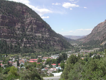
2004-06-24: Ouray
The town of Ouray is nestled in a valley. This shot was taken from the Million-Dollar Highway as we dropped into town after our run. Our campground can be seen in the distance at the mouth of the valley. All good things must come to an end but mark my words, we will return to this area.