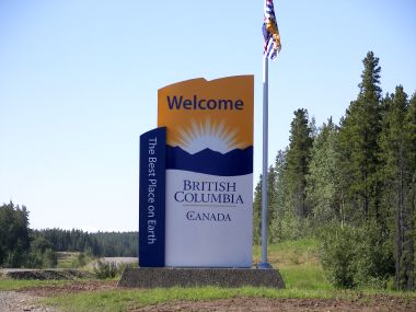
2006-07-29: British Columbia
As soon as we got on the Cassiar Highway we found ourselves back in British Columbia. This makes us realize that we really are getting closer to being back in the lower 48.
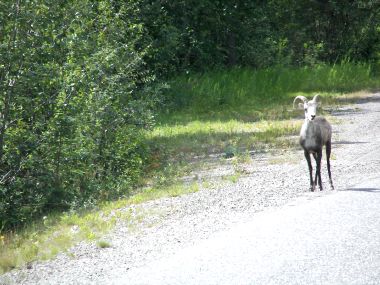
2006-07-29: Dall Sheep
This cute little sheep was on the road busily licking the salt. I guess if he can't find a natural lick, road salt is the next best thing!!

2006-07-29: Jade City
Our first stop along the Cassiar was Jade City. It is in this area that 75% of the world's jade is mined. We were shocked to learn that much of the jade sold in New Zealand is BC jade because the New Zealand natives have claim to the jade there. I sure would have loved to bring this chunk of jade home!
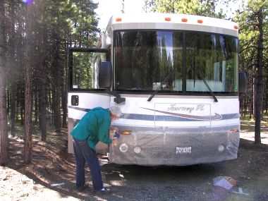
2006-07-29: Bubble Wrap
The time has come to wrap our rig in bubble wrap since tomorrow we begin our Cassiar experience. The problem with this road is that about 70 miles are gravel, dirt, washboard, potholes, etc. and the truckers use it because it cuts 124 miles off the trip north. They are paid by the load so don't slow down for rough roads and kick up rocks and debris.
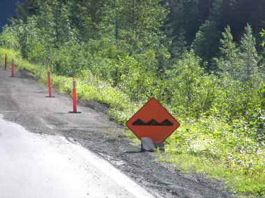
2006-07-30: Dreaded Sign
Here is one of the rough road signs and...
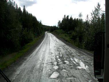
2006-07-30: Potholes
...these are some of the potholes we bounced through!

2006-07-30: Dease Lake
Dease Lake was the center for boat building during the Cassiar gold rush of 1872-80. Today it is a government center and kind of a lazy spot in the road with a beautiful lake.
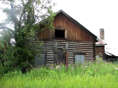
2006-07-30: Old Place
This abandoned house just intrigued me so I decided to include it here. I wish that moose rack were mine!
2006-07-31: Road To Telegraph Creek
Telegraph Creek Road was built in 1922 and was the first road into this remote area of northern British Columbia which was the domain of the Tahltan people. It is a narrow gravel 70-mile road with several sets of steep switchbacks.
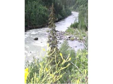
2006-07-31: Tuya River
The scenery along this road was incredible. This is a view of the Tuya River.
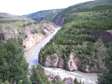
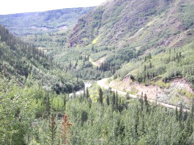
2006-07-31: Stikine Canyon
This area was called Grand Canyon of the Stikine.
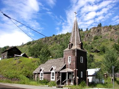
2006-07-31: St. Aidan's Church
Arriving in Telegraph Creek we found the Stikine Riversong, a renovated historic Hudson's Bay Post that offers nostalgic accommodations and delicious food (we can vouch for the food), some houses (some occupied and some abandoned), a few wilderness outfitter companies and this old but nice Anglican church.
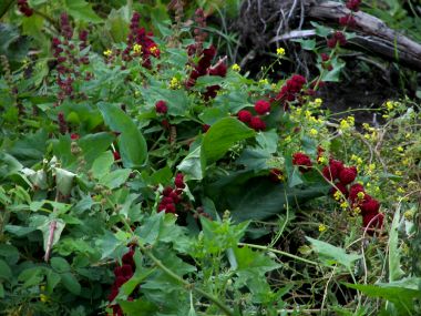
2006-07-31: Strawberry Blite
As you can tell, we've taken to identifying flowers during this trip and so I'm passing some of the prettier ones along to you. The color of this flower was regal.
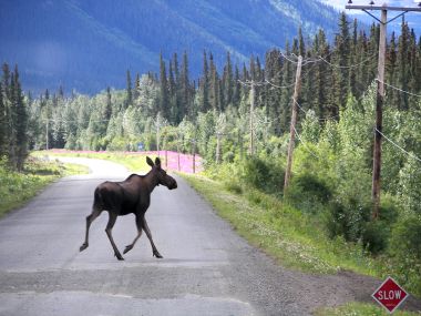
2006-08-00: Moose
The next leg of our Cassiar journey found us in an area where they were replacing the culverts. Lots of little gravel sections. Going slow has its benefits though because we were able to catch this photo of a moose crossing the road.

2006-08-01: Kinaskan Lake
We spent the night at Kinaskan Provincial Park and had a site with this incredible view. It is a large lake and from what our neighbors tell us the place to be with a boat if you like rainbow trout.
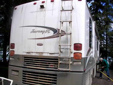
2006-08-01: Dirty Rig
Couldn't resist sharing this shot of our dirty, dusty rig. We decided there was no reason to wash it until we're done with the bad roads.
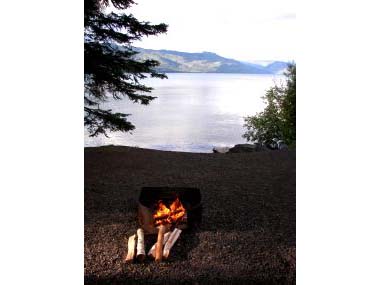
2006-08-01: Campfire
This setting was conducive to a campfire. We sat around the fire enjoying the warmth (yes it's chilly here) and the view.
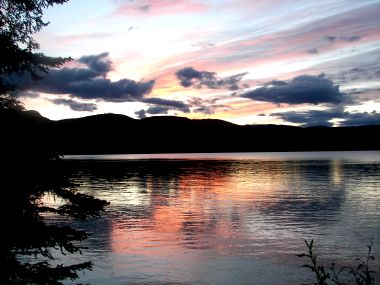
2006-08-01: Sunset
Though not dark yet, we did have a nice sunset that I felt compelled to share with you.
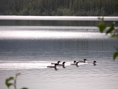
2006-08-02: Loons
We knew there were loons on the lake because we heard their distinct call last night and this morning. What a thrill to look out the window and see this flock of seven swim by.
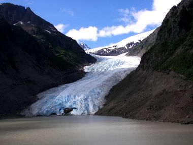
2006-08-03: Bear Glacier
We drove the Glacier Highway to get to Stewart and Hyder. It is so named because there are some 20-glacier formations overlooking the highway. Bear Glacier, which at one time reached the other side of the valley, was used for the movie "Insomnia".
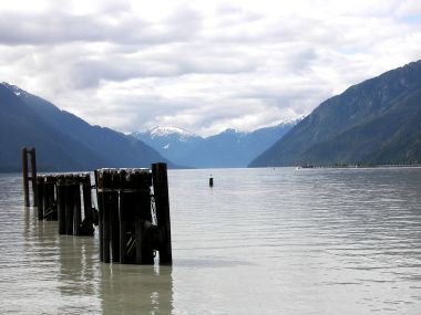
2006-08-03: Portland Canal
Stewart and Hyder are located at the head of Portland Canal, a narrow saltwater fjord approximately 90 miles long. The fjord forms a natural boundary between Alaska and Canada.

2006-08-03: Stewart, BC
Stewart is a small town big in history, nature and beauty. It claims to be one of North America's last pristine frontiers surrounded by breathtaking mountains, an emerald rainforest, clean fresh air and pure drinking water. Years ago, it was the spring and fall hunting grounds for the Nass Indians - today is just a funky little village.
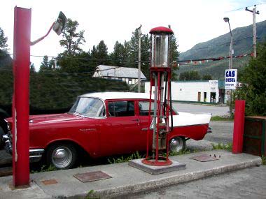
2006-08-03: Chevy
This 57 Chevy parked next to an old gas pump in the middle of town is so Stewart.
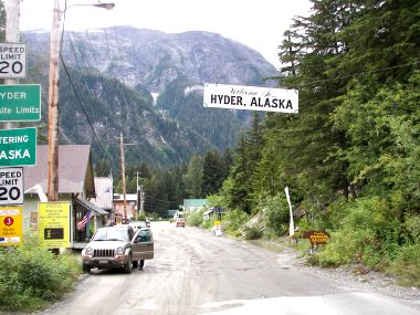
2006-08-03: Hyder, Alaska
Continuing through Stewart about 2 miles we enter back into Alaska and dirt roads full of potholes. Gold and silver mining dominated the early economy of Hyder with the discovery of rich silver veins in the upper Salmon River Basin in 1917-18. Today Hyder's claim to fame is being the friendliest little ghost town in Alaska.
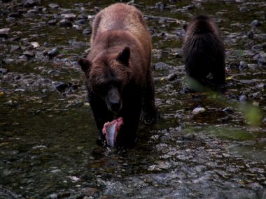
2006-08-03: Mama and Her Triplets
About 4-miles from Hyder in the Tongass National Forest is the Fish Creek Wildlife Viewing Area. Here the Forest Service has constructed a boardwalk along the Fish Creek in an area where the chum salmon come to lay their eggs. We were amazed at the size of the fish. All of a sudden this female and her cubs appeared and began feeding. We stood for probably 1-1/2 hours totally entertained.
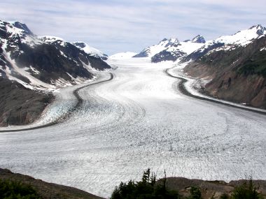
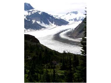
2006-08-04: Salmon Glacier
We drove out past the bear viewing area today to see spectacular Salmon Glacier. The amazing thing was that the road was actually above the glacier - what an incredible feeling looking down on this huge glacier.
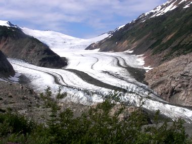
2006-08-04: Berendon Glacier
We continued further up the winding dirt road to Berendon Glacier which was not quite as dramatic as Salmon Glacier but pretty just the same.
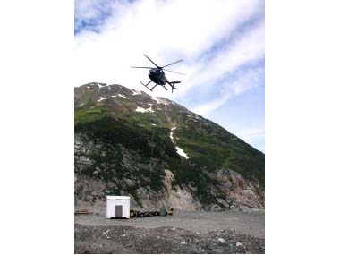
2006-08-04: Air Lift
Here at the Berendon Glacier are the remains of the old Granduc Copper Mill. We also got to watch two helicopters air lifting supplies to working gold, silver and copper mines located further into the canyon. We were intrigued as we watched the pilot hook up two 55-gallon fuel drums and take off with them. At dinner we met a gentleman from England who had actually worked at the Granduc in 1966. It was interesting seeing the photographs he had from his time at the mine.
2006-08-04: Miners Cabin
This old miners cabin stood vacant in the forest in the shadow of a glacier. What a picture!
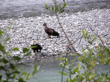
2006-08-05: Eagles
We decided to go out to Fish Creek in the late afternoon to see if the bears feed then too. On the way out we spotted this eagle with two immatures feeding on a salmon downriver from where we view the bears.
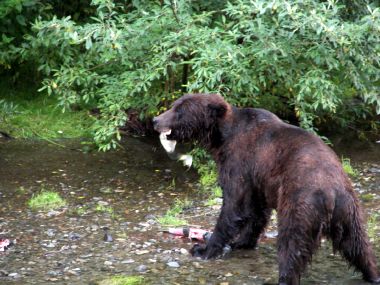
2006-08-05: Male Grizzly
We had stood around watching the salmon for about 30 minutes and decided to leave. We were almost to the parking lot when this man came running toward us saying there is a bear at the end of the boardwalk. Needless to say we turned around and went back. We were rewarded with the antics of this huge male (Al thinks he was at least 1/3 bigger than the female we saw the other night) as he busily caught his dinner (or snack).
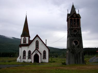
2006-08-07: St. Paul's Church
We left Stewart and stopped in the village of Kitwanga. There isn't much here but we did find this nice old Anglican Church. The bell tower standing beside the church houses the original bell from the 1893 bell tower.
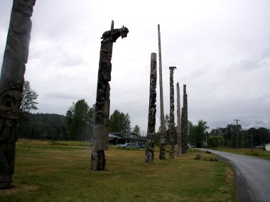
2006-08-07: Totems
The Native reserve of Gitwangak is also in this area. Here we were able to view some of the finest authentic totem poles in the area. These were amazing totems.
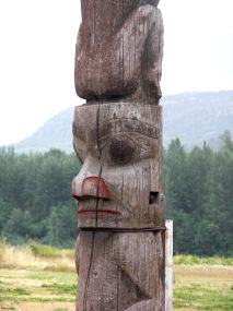
2006-08-07: Up-Close
Just to give you an idea of the detail of some of the totems I took this close-up shot. You can see that the totems were at one time painted but have been left to weather naturally.