
2009-07-28: Dtaksiwe'
Dtaksiwe' means Cluxewe in the Kwakiutl dialect spoken by the Fort Rupert Band. It means "place of many changes" because this area where the river meets the ocean is constantly changing. This welcoming spirit holding a copper, a sign of wealth, is at the entrance of the place we have called home for a week.
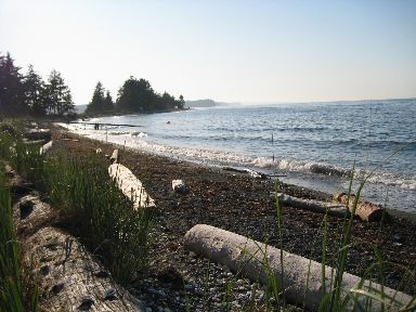
2009-07-28: Beach
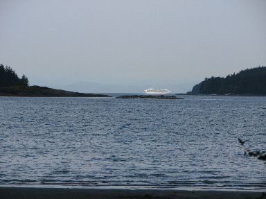
Although our campsite isn't right on the water we can see the water and the cruise ships passing us as they make their way down the inside passage to and from Alaska.
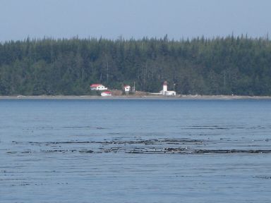
2009-07-28: Pulteney Point
Across Broughton Strait on Malcolm Island is the Pulteney Point Light which helps guide the big ships.

2009-07-28: Broughton Strait
Tryna felt the need to wade around a little even though the water was cold.
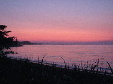
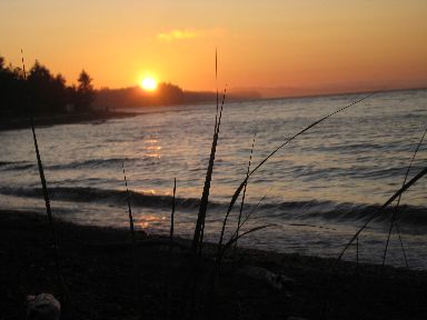
2009-07-28: Sunset
The sunset and color after are absolutely incredible here!
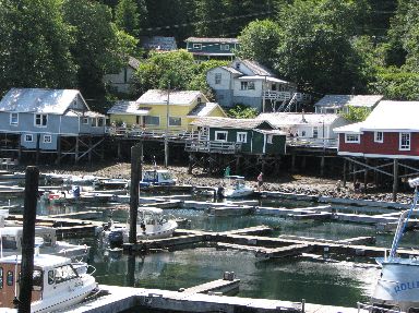
2009-07-29: Telegraph Cove
This peaceful bay with its colorful buildings served as the northern terminus of the telegraph line along the coast of Vancouver Island and since has became a logging and salmon fishing area.
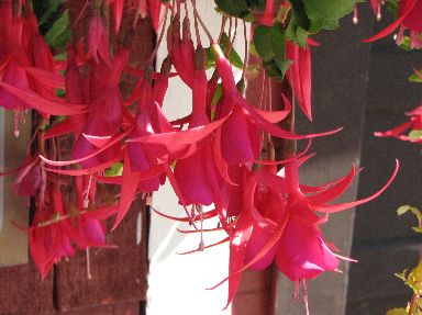
2009-07-29: Fuchsia
We have never seen such huge, plump fuchsia as we saw here in Telegraph Cove.
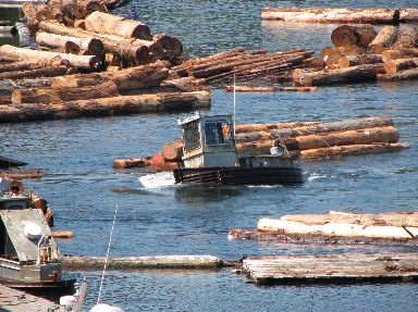
2009-07-29: Beaver Cove
On the way back to camp we stumbled on this log sorting yard. The logs are first sorted by size, and then strapped into small bundles. These bundles are then grouped together to form a raft or boom which when complete is 63 feet by 363 feet. All of the moving of the logs were done by these little bully boats which are kind of like a tug boat but are specialized for this kind of work. Watching them in the water was a kick as they turned and moved and swamped themselves with water.
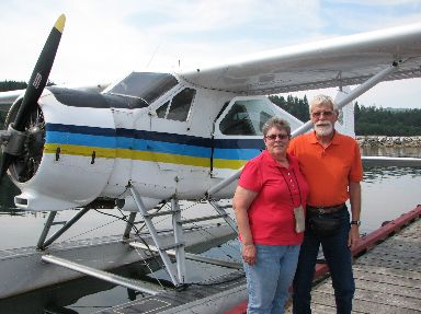
2009-07-30: Happy Birthday
In honor of my 65th birthday, we decided to check off another life-list item and take a float plane ride. We flew in "Pacific Eagle", a de Havilland Beaver float plane. What a thrill!
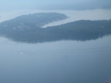
2009-07-30: Cormorant Island
Leaving Port McNeill we flew over Cormorant Island which is shaped like a horseshoe.
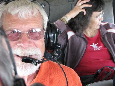
2009-07-30: The Plane
Tryna got to ride co-pilot while Al sat in the second row of seats with Pam Dawson and her daughter, natives who were returning to their home in a remote village.
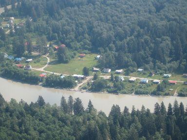
2009-07-30: Kingcome
The Dawsons live in the village of Kingcome which one can reach either by floatplane or boat. The native village is home to 80 residents and is part of the same Kwakwada'wakw First Nation as the one who run our campground. There are 15 small native groups in this area that all belong to the same council.
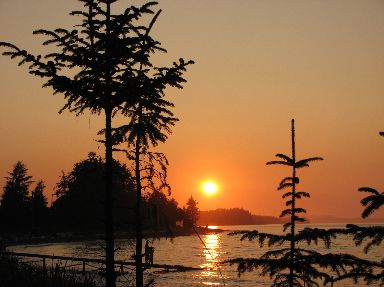
2009-07-30: Sunset
Another incredible sunset.

2009-07-31: Big House
Today found us in Fort Rupert village, another local native village. The Big House is used for ceremonial purposes. The front design represents the Sisiutl, a double headed sea serpent and frog. These crests are common to most of the Kwakiutl Nation. We were lucky to have Liz Cadwallader join us in our car and give us a narrated tour of the village.
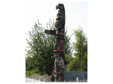
2009-07-31: Totem
There were totem poles in many of the yards throughout the village. Many of them were carved by members of the Hunt family who are one of the main families of the village.
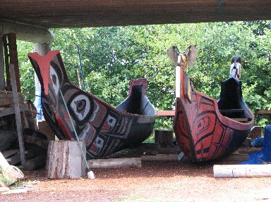
2009-07-31: Coppermaker Gallery
At Calvin Hunt's Coppermaker Gallery in the village we were able to see several completed canoes as well as totems in progress.

2009-07-31: Hudson's Bay Store
In the middle of the village property is a section of land that was established in 1849 by the Hudson's Bay Company and operated as Fort Rupert until 1881. This roof was part of the original general store that was later granted to Liz's family and became the first "corner store" on the north island.
2009-07-31: Storey's Beach
Our last stop of the day was at Storey's Beach, a beautiful sandy beach. As we were enjoying the water and sand, we looked up and saw another cruise ship going by on its way south.
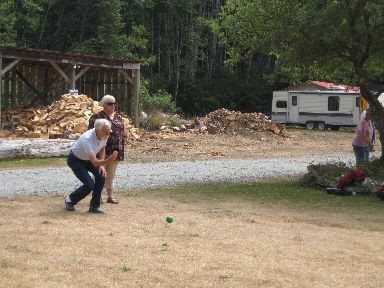
2009-08-01: Bocce
The campground had many activities in celebration of BC Day. There were native crafters selling their carvings and other handicrafts, there were many activities for the kids like hamster balls, face painting and the like and there was the 4th annual bocce tournament. We entered along with 16 other teams and after three games in the elimination tournament, we were declared 3rd place winners and awarded t-shirts and hats. What a surprise!
2009-08-01: Sunset
We just can't get enough of these north island sunsets!
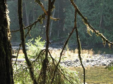
2009-08-03: Marble River
Today we decided to take a ride over to Port Alice which is on the western side of the island. On the way we stopped for a while to enjoy the Marble River.
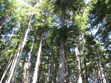
2009-08-03: Forests
Our trip down this wonderful windy road took us through beautiful cedar and birch forests.
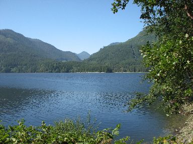
2009-08-03: Port Alice
Port Alice is a sleepy little village on Neroutsos Inlet. Its claim to fame is that is BC's first instant community. In 1965, the entire community was moved from its original 1917 site to its present location. I tried to find out why but no one seemed to know.
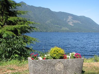
2009-08-03: Sea Walk
Port Alice has a walkway from town along the water to a nice little picnic area with this incredible view.
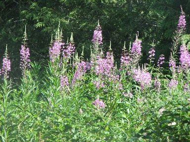
2009-08-03: Fireweed
The fireweed here on the north island brings back fond memories of our trip to Alaska.