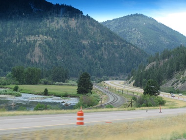
2014-07-22: Route 190
Our journey took us on Montana Route 2 which was once again one of those roads where the highway, the river and the railroad meandered side by side.
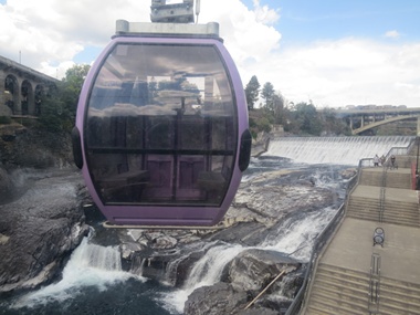
2014-07-23: Spokane Falls
We took the "SkyRide Over the Falls" which claimed spectacular views of the second longest urban falls in the United States. It was a 15 minute ride in a gondola that claimed to offer the best, convenient, easily accessible, upfront views of the Spokane Falls that runs through downtown Spokane. We traveled past art deco City Hall, then gradually dropped down 200 feet over the Huntington Park Natural Area. From there, we continued across the Spokane River in front of one set of falls, under the historic Monroe Street bridge and then returned to Riverfront Park. It was pretty BUT ours was the last car out because the temperature inside had reached 100 degrees!
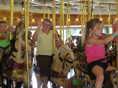
2014-07-23: Merry-Go-Round
The Riverfront Park Carousel, also known as the Looff Carousel, was originally built in 1909 by Charles I. D. Looff. The carousel was a gift for Looff's daughter Emma Vogel and her husband Louis Vogel, who owned Natatorium Park in Spokane. It remained at the park until 1968 when the park closed. The carousel was relocated to its present location at Riverfront Park in 1975 where it continues to operate. The carousel contains 54 horses, 1 giraffe, 1 tiger and 2 chariots, all hand carved by Looff himself. It also has a brass ring dispenser that allows the outside riders to grab a ring.
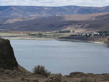
2014-07-24: Columbia River
Heading toward Ellensburg we got our first glimpse of the Columbia as it flowed through the canyon. I'm not sure where I thought the Columbia came from but was surprised to see it here.
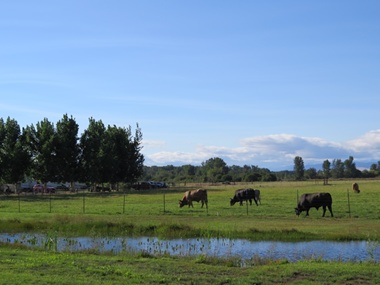
2014-07-24: Bulls
We knew our campground was on a working farm but were sure surprised to drive in and see all the bulls in this pasture! A few of them looked like buffalo from a distance.
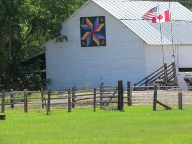
2014-07-24: Rail Fence Star
Many of the barns in this area have beautiful quilt squares painted on them. This one was on the barn right on the property where the campground was.

2014-07-25: Davidson Block
It was so much fun wandering around historic downtown Ellensburg. The Davidson building was one of the brick buildings in construction in downtown Ellensburg before the fire of July 4th 1889. Designed by J. B. Randal and built by John B. Davidson, an Ellensburg attorney, the building cost $42,000 to construct. The two story, 90 x 120 foot building was constructed of brick shipped from Chicago. Completed in January 1890, a large phoenix was placed on the Fourth Street side of the building and has since been often called the Phoenix Building. Businesses have always occupied the ground floor and various hotels have been located in the second story.
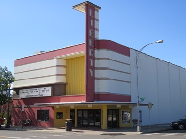
2014-07-25: Liberty Theater
On the outside of the Liberty Theater, strong geometric lines mimic the bow of a mighty stationary ship plowing through the sea of night, its neon lights beckon would-be adventurers. This art deco building was built by entrepreneur Jim Shields in 1937 who built it in the same then-contemporary style in direct competition with the Audion Theater. Kind of amazing that this little town is home to not one but two art deco theaters!

2014-07-25: Double Windmill
Another barn in town with a quilt square on it's side. This design is called a double windmill.
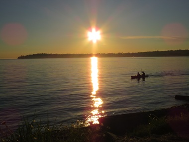
2014-07-29: Birch Bay Sunset
We decided to go to Birch Bay for a few days so we could share that area with our friends. After dinner tonight we headed to the beach so we could catch one of the fantastic Pacific Northwest sunsets. We weren't disappointed!
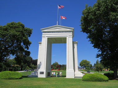
2014-07-30: Peace Arch
We are located just a few miles from the border between the US and Canada. In the median between the traffic going north and south over the border is North America's first International Peace Park which was established by the citizens of the US and Canada in 1921. Peace Arch is a 67-foot tall concrete arch that straddles the border of the two nations.
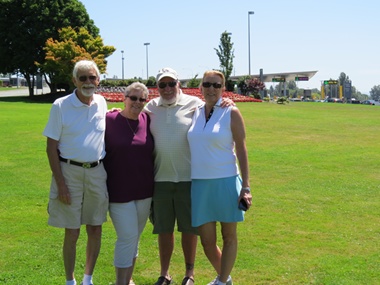
2014-07-30: Friends
Our friends from North Carolina, the Forresters, have joined us again. What fun it is showing friends some of our favorite places in this part of the country. Notice the US flag in flowers behind us - the Canadian flower flag is on the other side of Peace Arch.
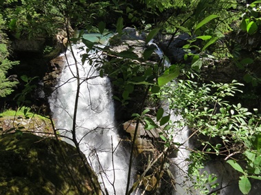
2014-07-31: Nooksack Falls
Today found us heading toward Mount Baker. On the way we stopped at beautiful Nooksack Falls, a waterfall along the North Fork of the Nooksack River. The water flows through a narrow valley and drops freely 88 feet into a deep rocky river canyon. The falls were featured in the hunting scene of the movie The Deer Hunter.
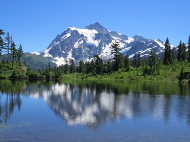
2014-07-31: Picture Lake
Picture Lake is the centerpiece of a strikingly beautiful landscape in the Heather Meadows area of Mount Baker State Park. This classic alpine vista of Mt. Shuksan mirrored in Picture Lake is one of the most photographed mountain scenes in North America. Mount Shuksan is a glaciated massif and has an elevation of 9,131 feet.
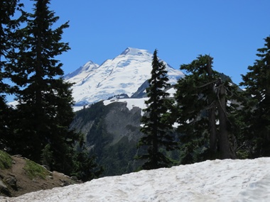
2014-07-31: Mount Baker
After Mount Rainier, Mount Baker is the most heavily glaciated of the Cascade Range volcanoes; the volume of snow and ice on Mount Baker is greater than that of all the other Cascades volcanoes (except Rainier) combined. It is also one of the snowiest places in the world. At 10,781 feet, it is the third-highest mountain in Washington State and the fifth-highest in the Cascade Range. We expected it to be cold when we arrived but instead found that it was a delightful 75 degrees.